Lights and Shadows Collection: Striking Structures
They’ve stood the test of time as tangible evidence of the rich history of civilizations, earning UNESCO World Heritage Site designations and the pride of humanity. Impressive manmade structures scattered across the globe, from the lush lowlands of the Yucatán Peninsula to the Nepali foothills of the Himalayas. Much like they do today, these sites captured the imagination and admiration of pioneering travelers more than a century ago. As part of the collection Lights and Shadows – Photographs from the Royal Geographical Society (with IBG), these snapshots both preserve an indelible historical record and serve as an introduction to the Royal Geographical Society’s archive of over 500,000 historic images. Documenting and observing the world through photography has been a focus of the Society’s own work since the 1880s, when John Thomson was appointed as the Society’s official ‘Instructor of Photography’. Thomson referred to the medium as ‘the absolute lights and shadows of all things seen and that are of value in expanding our knowledge of the world in which we live’.
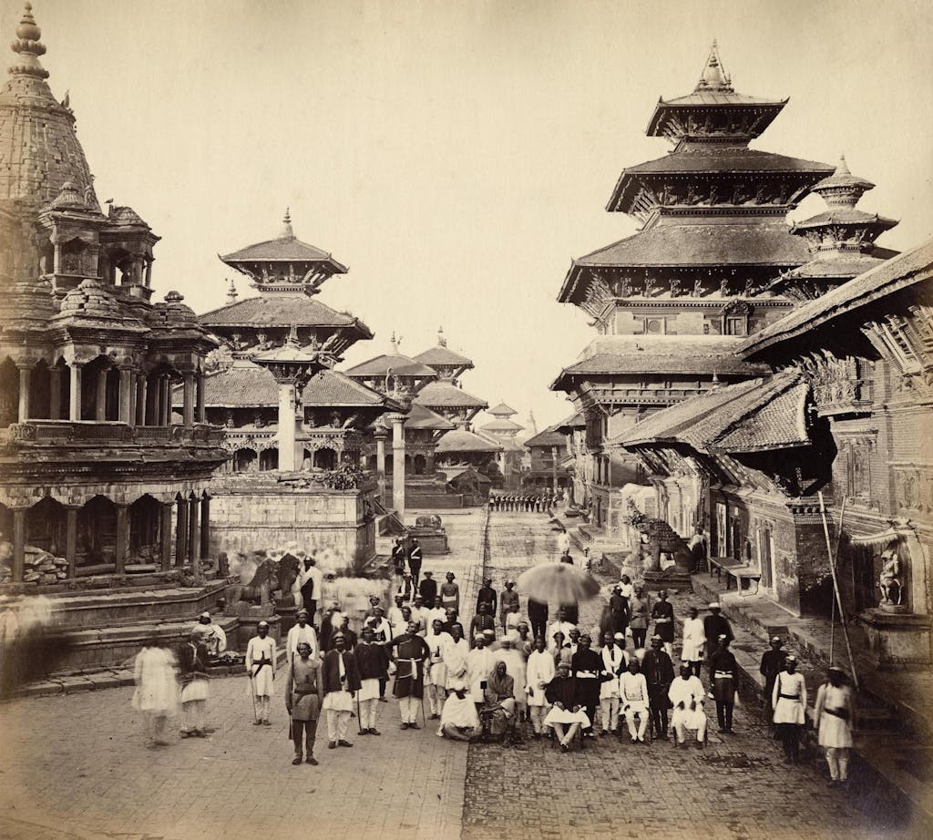
Durbar Square and Adjacent Temples in Patan, Nepal

Clarence Comyn Taylor departed for Asia in 1850 and served in the East India Company army before transferring to the Political Service. He was posted to Kathmandu as Assistant Resident at the time when the Government of India had begun its commission to document the people and monuments of the Indian sub-continent in photographs between 1850 and the early 1880s.
As a keen and talented ‘amateur’ photographer, Comyn Taylor was quickly recruited to document the landscape and people of Nepal. He was responsible for the earliest existing photographs of the country, including those of the temple complex of Pashupatinath, part of a collection of albumen prints. The process by which the albumen found in egg whites is used to bind the photographic chemicals to the paper was the most common form of photographic positive print from the 1850s through to the start of the twentieth century.
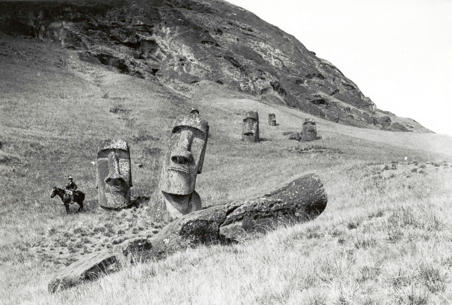
Easter Island Statues

In 1910, archaeologist and anthropologist Katherine Routledge and her husband William first began to think of travelling to Easter Island and conducting fieldwork there. Both had previously travelled extensively, including two years spent in East Africa. Although earlier European visitors to the islands, including J. Linton Palmer, had commented on – and often drawn or painted – the moai, or statues, by 1910 there had still been no serious scientific study of the famous figures, and to both Katherine and Scoresby this presented an opportunity.
Arriving at Easter Island on 29 March, 1914, Katherine immediately began preparations for her planned programme of fieldwork.
Throughout the project, she worked closely with Juan Tepano, the headman of Hanga Roa village, who assisted Katherine as interpreter, protector, collaborator and friend. As well as surveying, sketching, and photographing the moai, and the carvings upon them, Katherine also carried out extensive ethnographic interviews with the inhabitants of the island, preserving much of their culture which might otherwise have been lost.
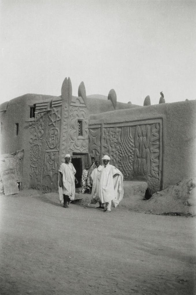
House Walls in Kano, Nigeria

Elizabeth Wilhelmina Ness was the first woman to become a member of the Royal Geographical Society’s Council in 1930. In 1953, she endowed the Society’s Ness Award to be presented ‘either to travellers who have successfully carried out their plans, or to encourage travellers who wish to pursue or follow up investigations which have been partially completed’. Amongst her own travels, Ness was the first European woman to cross the Sudan on horseback and the first to cross Lake Kivu in Rwanda on a fleet of canoes.
Ness undertook a journey from Beirut across the Syrian desert to Isfahan, which she described in her book Ten Thousand Miles in Two Continents, published in 1929.
A skilled photographer, documenting all of her journeys in meticulous photographic detail, Ness was also one of the first travellers to use 16mm cinematographic film in colour.
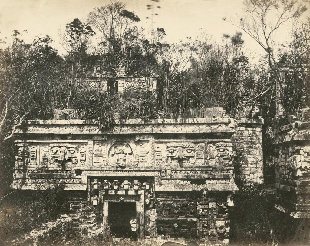
Nuns Palace at Chichen Itza, Yucatán, Mexico

Desire Charnay was a French traveller and archaeologist, notable both for his explorations of Mexico and Central America, and for the pioneering use of photography to document his discoveries.
As a young Frenchman, Charnay travelled to New Orleans where he taught French. He was the first to photograph the Mayan ruins at Mitla, Izamal, Chichen Itza and Uxmal, between 1857 and 1860, whilst travelling on expeditions funded by the French Ministry of Education under Napoleon III. The success of his resulting book Cités et Ruines Américaines, published in Paris in 1863, led him to devote himself to Pre-Columbian Mexican and Mesoamerican archaeology. In 1880-1883 he again visited the ruined cities of Mexico. Pierre Lorillard IV of New York City contributed to defray the expense of this expedition.
Charnay elaborated a theory of Toltec migrations and considered the prehistoric Mexican to be of Asiatic origin, because of supposed observed similarities to Japanese architecture, Chinese decoration, Malaysian language and Cambodian dress. His photographs were the first to document the sites that he encountered.
This article has been produced in collaboration with Silversea’s Corporate Business Partner, the Royal Geographical Society (with IBG), which enriches guests’ expeditions with over 500 years of geographical travel and discovery. Find out more here.
